The Long Ride

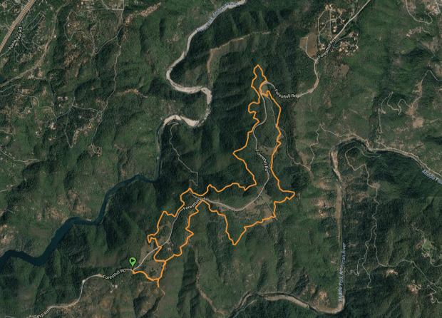
On August 7th of this year, three women decided to take a trip on their horses from Tuolomne Meadows in Yosemite to Donner Summit.  The trip was supposed to be 200 miles. However, after day 5, with equipment failures, terrain that is not horse friendly whatsoever, snow,  and the extensive time it takes to pack and unpack each day at camp, they fell behind and knew they would be ending the ride for this season sooner than they planned.

Did this discourage them?  Heck NO! They are going back next year armed with experience and lessons-learned to continue where they left off. I plan on hiking behind them filming each step of the way.

If you are debating weather to traverse this section of the pct on horseback, take a look at this film.

A ROUGH RIDE ON THE PCT!

Three friends, four horses and a lot of guts! These women traversed 76 miles of the Pacific Crest Trail from Tuolumne Meadows in Yosemite to Kennedy Meadows North. It was a HUGE snow year for the Sierra, and hikers had a difficult time in this very stretch. Some came close to death and one did lose her life.  This same stretch on horses is almost impossible.  As the PCT is said to be made for horses in mind, in reality it’s not as these women soon found out. The full documentary will be coming soon!  Here is the trailer!


PCT Re-Supply Shot- So, I Did This Instead!

I was supposed to meet up with some lady PCT horse riders in the Sierra for their re-supply but they are two days behind because of snow and down trees in mid August!  They are averaging about 7 miles a day. Getting over the passes is slow going for them. Hikers can get around these obstacles a lot easier than horses!  They started in Tuolonme Meadows (Yosemite National Park) Aug 7 and was supposed to be at Kennedy Meadows North on Aug 13 (today).  That’s not going to happen.   So, with my plans for a mountain weekend on hold, I did this instead!

his is a cover song called Barton Hollow by the duo The Civil Wars.

Enjoy!


Just a Little Coo-Coo on the Loch Leven Trail!

In this episode of Twylaworld, we head up to almost 7000 feet to  some nice and refreshing alpine lakes for swimming and toe dipping.  It’s 107 degrees in the Sacramento Valley, so it’s time to head up into the Sierra for some cooler temps. The snow is FINALLY starting to disappear!

A six mile round trip hike didn’t sound like a big deal when I looked at the map, but you are going to climb 1633 feed in the three miles in and there are lots of  boulder steps to traverse.  You will really work for this swim, but its TOTALLY worth it!  There are three large lakes that are very close together with a fourth smaller lake that is tucked between the second and third large lake. The second lake is the largest and most popular for backpackers.  The water is clear and oh so refreshing!

Take your lunch, swimmin’ britches, sunscreen, bug spray and water. There is a place to filter water along the way if you run out.  The views are spectacular and the lakes are crystal clear!

I would consider this hike on the harder side.

I want to go back and camp next time!

A MONSTER Creek Hike

2017 is the year of record snow and raging waters in California. I’ve been hearing about hikers fording creeks and streams in the High Sierra and having near death experiences. Hiking in the mountains definitely has its challenges this summer!  Fordyce creek is in Northern California portion of the Sierra just North of I-80 off of Hwy 20. As you will see be this vid, this creek is a flowing monster!  Take a rainy walk with me as we hike from Lake Spaulding to  Fordyce Creek Falls.

I Almost Stepped on a Rattlesnake!

Today on this episode of Twyla World we take a nice hike from the American River Confluence to the town of Cool. It’s only 6.2 miles round trip, however there is a little of a climb to get out of the canyon. You can make this hike much longer if you do the trails in Cool that loop around back to the trail into the Canyon. AND we met a rather large rattle snake!


That thingy with the Arrow that Points North

A while back, I bought the cheapest Compass that was hanging on the rack at REI. It was this little thing that hung off the strap of my backpack that didn’t have dials or anything. It just gave you a direction. I figured I could at least use it to get myself north, south, east or west. Sounds easy enough!  If I keep walking West, I’d eventually hit the Pacific Ocean and then I’d know for SURE where I was. Of course I’d probably die before I got there and never see the Ocean. So I bought a map.  A large fold out piece of paper of shades of green and tan with a gazzillion squiggly lines and numbers.   I look at the map then at the compass, look at the map, then at the compass.  Hmmmmm..   Nothing made sense.

So, I did what every person thirsting for knowledge does… I go to YouTube. It’s there I learn from some fine compass reading YouTubers that I have to account for Declination in order to use the map with the compass. Something about the curvature of the Earth, True North, Magnetic North.. WHAT?  THERE ARE TWO NORTHS?  What the hell is going on here?

I needed to get to the bottom of this Two Norths thing (sounded hoaxy to me) and signed up for a class from REI.

Now, I can read a Topography map (sort of-need practice) and read my compass and I know the difference between the “Norths.”  Oh, and I learned something VERY IMPORTANT.  I had to keep “Fred in the Shed.”

Sesame Street in the Woods? What?

In this episode of Twylalword, we go on an 11 mile hike in the beautiful foothills of Northern California near the town of Foresthill. This is a GREAT hike and has very nice ups and downs and is the perfect interval workout. This trail is shared with mountain bikes and horses. Beautiful in the Spring!   The trailhead is 3.7 miles from the center of the Foresthill Bridge on the Auburn/Foresthill Road. (Gate 118)  You will need to display your state park poppy pass, or pay 10.00 for the day to park.

We come across a weird ode to Sesame Street, a GIANT tire in the middle of the woods, and we get to hear the story about a guy dubbed “sticky pants”!

Sit back and enjoy the scenery!

map

Heavenly Landings! It’s a Pilot

A long time ago, I took flying lessons while I was working at a small airport in Redding CA.  I never did get my license because I ran out of money – Like soooo many.  However, I did spend many years flying in the back seat of a Piper Cherokee every day as a traffic reporter in the Sacramento area.  So, I eventually got paid to fly!

My husband is the pilot these days. He’s had his private license since 1996. He’s always talking about wanting to fly a float plane!

I’m in the process of putting together an entire wall of aviation for him in the master bedroom. Its going to be loaded with my artwork and other aircraft items such as a prop, shelves that are planes coming out of the wall, etc. Here is the BIG painting that I did yesterday.  It’s 24×30 on canvas. (HUGE) I call it Heavenly Landings. What a place to land a plane, on a mountain lake!  WOW!  I do call that heaven!

If you want this painting for yourself, you can purchase the print on canvas or framed here.  You can even order cards etc. img_2912for-wordpressimg_1595