
Coming from living at 300 feet above sea level in California to 6850 feet above sea level in New Mexico had it’s challenges at first. I had a little bit of altitude sickness (headache, no appetite and lethargy for the first week, but I adjusted slowly. Riding my bike uphill to the mailbox was a bitch but I did it daily to get those red blood cells built up! But, since I’m already half way there, why not go up a little further? Just 35 minutes from my house, the mountains rise to over 10K feet! Let’s go check it out, shall we?
Category: Hiking
First Maltby Descendant’s Journey to Historic Maltby Lake
HISTORIC ACHIEVEMENT: First Maltby Descendant Conquers Maltby Lake
In the early 1940s, the owner of Maltby’s Resort at Upper Twin Lakes in Mono County, California, ventured high into the Sierra mountains. Hal Maltby, on a scouting trip for deer to benefit his lodge’s customers, stumbled upon a hidden gem: a pristine lake sitting above 9,000 feet that wasn’t marked on any Forest Service map.
Fast forward 81 years, Hal’s great-grandson, Carson, undertook the same challenging trek to locate this family legacy, now known as Maltby Lake. This journey not only retraced Hal’s footsteps but also forged a new chapter in their family’s history.
Watch the video, edited and narrated by me, to delve deeper into Hal’s discovery and Carson’s epic, albeit arduous, journey to Maltby Lake.
New Hiking Trail near South Lake Tahoe | California Ranch Move
My time is getting short in California! In between all of the house projects for the upcoming sale of the ranch and move to New Mexico, I’m trying to find some time to get Sierra hiking in. Here is a trail near South Lake Tahoe that I haven’t done before! This trail is considered moderate at 7.2 miles round trip and 1300 feet of elevation gain, but you are rewarded a nice cool lake to take a dip!
What’s in my Day Hiking Back Pack?

Even if I’m doing an easy 5 miler in the wilderness, I always carry the 10 essentials and MORE! After having to almost spend the night in the Lassen National Park wilderness completely unprepared after a short hike to a lookout tower, I learned a hard lesson! I now carry items to sustain me in the wilderness until help arrives. This could be hours or even days!
Disclaimer: This is what I carry. You may have different ideas! I’d love to hear them!
Here is the link to the fiasco I was involved in a few years ago where I almost had to spend the night in the freezing cold forest!
The Story about my (almost) night in the mountains!
My Day pack is an REI Trail 40 and Here’s what’s in it! (NONE of the links are affiliate. All are non-sponsored)
- First Aid kit: Put together what you like. I also add Leuko tape for blisters.
- Fire Starting Materials (Cotton Balls soaked in Petroleum Jelly work great) Don’t forget the lighter or waterproof matches. Even though a fire could save you from freezing to death, you could possibly start a devastating forest fire, even in winter so be very careful! Learn how to start, maintain, and extinguish a life-saving survival fire. There are many videos on Youtube!
- Compass & Maps: https://amzn.to/2t2yoQ4 My REI Compass Class Video https://youtu.be/iMaSsgeEHno?si=V5iI963sQcyIt_Nc
- Signal Mirror: https://www.amazon.com/s?k=signal+mirror&ref=nb_sb_noss
- Whistle and Air Horn
- Emergency Bivvy Bag: https://amzn.to/2ykuwyS
- Emergency “space” Blanket (Amazon): https://shorturl.at/YR3jO
- Sawyer Squeeze Water Filter: https://amzn.to/2tbtCyV
- Water Collection Bag (Amazon): https://rb.gy/r1rkil
- Water Purifying Tabs in case your water filter fails. Shop on Amazon
- Small Gerber Knife: https://amzn.to/2t0wTlz
- Neck Knife https://mtknives.net/
- Light folding Saw (sometimes-depending on conditions): https://amzn.to/2HSFVWj
- Tyvek Sheet (5×5 ft) : https://rb.gy/arbnl5 This is super light (weighs nothing), waterproof, and can be used as a ground sheet, wind block, shelter, etc. I’ve used this to sit in the snow!
- Inreach Mini with Subscription: https://www.garmin.com/en-US/p/592606
- Bug Head Net: https://rb.gy/c8q42f
- Bug Spray with Deet. Good luck using the foo foo kind with no Deet. These mountain skeeters mean business and laugh at your feel-good perfume as they bite the living hell out of you. Trust me, I’ve tried everything!
- Anker Charging Station (20,000 mil Amp) https://amzn.to/2l9Nwa5
- Butt pad: https://amzn.to/2t1aS5Y
- Cooling towel: https://amzn.to/2LPw2Lt
- Paracord (Amazon): https://rb.gy/5tc3c1 About 15 feet will do
- Rain Gear (Amazon): https://rb.gy/sqwjep This rain gear is super light and works! Mountain thunderstorms are real and can really dump water!
- Salt Tabs and Electrolytes
- Extra socks and long sleeve top
- Down Jacket – In case I have to spend the night in the woods. Temps drop dramatically at night at high elevations.
- P-Style (This one’s for the girls. Guys… you have one built-in) Amazon https://rb.gy/7vxv3w
- Day Pack Rain Cover or Garbage Bag
- Fanny Pack: This is the one I have and I love it! https://www.thrupack.com/
- FOOD! Pack extra in case you get stuck for a while!
A word about navigation apps and what I use:
I rely on a few essential navigation apps, tested and trusted by hardcore mountaineers and thru-hikers. These apps provide reliable navigation and have been field-tested by the toughest adventurers. Here are my go-to primary choices:
-
Gaia GPS is a powerful app offering detailed topographical maps, weather data, fire information, private property boundaries, and many other useful layers. It’s widely used by serious backcountry hikers. While the free version offers many features, the paid version is highly recommended for those who frequently venture into remote areas.
-
FarOut: FarOut is particularly valuable for the three long trails: the Pacific Crest Trail (PCT), Continental Divide Trail (CDT), and Appalachian Trail (AT). A one-time fee allows you to download the trail you hike most often—for me, that’s the PCT.
These are my secondary apps:
-
AllTrails: AllTrails is excellent for researching and finding hiking trails. The paid version includes a cool 3D animated feature, plus up-to-date trail data from recent hikers, which is especially helpful during the spring thaw. However, be cautious with the navigation feature, as it has been known to be unreliable on backcountry trails.
-
Wikiloc: Wikiloc is another useful app for researching trails and discovering new hiking destinations.
-
PeakFinder: PeakFinder can be hit or miss when identifying peaks. It’s great when it works, but don’t rely on it in a moving car. The app is free.
Other Things I take:
Hiking Umbrella – Trekking Poles- Water Bladder-Cell Phone- Hat- hiking gloves- roll of duct tape wrapped around chapstick, garbage bag, toilet paper (pack out used!), Hand warmer, Smart water bottle, it fits the water filter, and A FRIEND! Don’t hike alone!
Here is what’s in my multi-night (backpacking) bag!
I Get a New Trail Name? NO!!!
What a difference a year makes in the Sierra. This time last year, there was about 60 or more feet of snow, completely burying homes, cars and of course trail signs! This year, there was beautiful snow, but all trail signs are prominently visible. Let’s go for a snowshoe up to Castle Pass!
76 Year old Started Backpacking at age 68!
Meet my friend Jo Anne. She’s 76 and is a backpacking fanatic! She started this journey at age 68 but just last year, (2022) she had to overcome a huge obstacle to continue on her backpacking journey!
Last week Jo Anne and I went on a backpack into the Hoover Wilderness in the high Sierra of California. Check out her incredible INSPIRATIONAL story! Her message.. Get off the Couch!
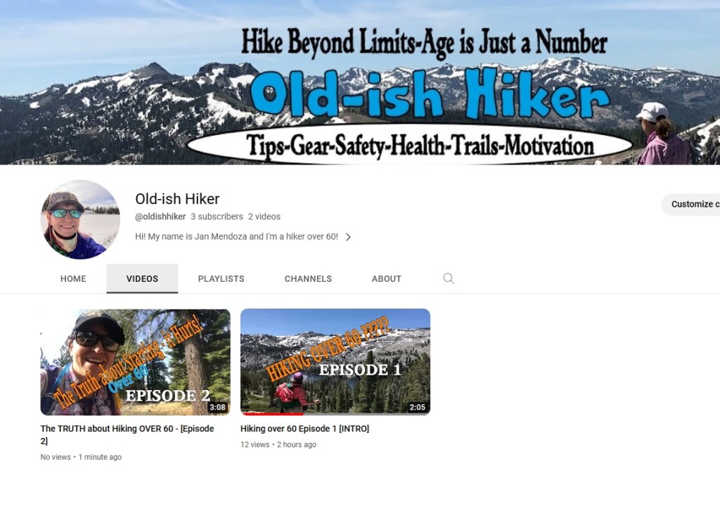
PS.. this Youtube vid is on my new channel geared to senior hikers. If this is your thing, and/or you’d like to watch other inspirational stories of outdoorsy seniors, SUBSCRIBE to that channel “Old-ish Hiker”
WATCH INSPIRATION HERE!
ANNOUNCEMENT! New YouTube Channel!!!
Hello, nature enthusiasts! Today, I’m excited to introduce my new YouTube channel, “Old-ish Hiker,” specially curated for adventurous souls over 60 who are passionate about hiking and exploring the great outdoors. As some of you may know, I’ve been running a channel called “TwylaWorld,” but I’ve decided to shift my focus and dedicate more time to this new venture. In this blog post, I’ll share some details about Old-ish Hiker, its purpose, and why you should be a part of this exciting journey-even if you aren’t a hiker!
- A New Adventure Begins: Old-ish Hiker
Old-ish Hiker is the latest addition to my YouTube ventures, catering specifically to the vibrant community of hikers aged 60 and above. As we age, our interests and preferences change, and this channel aims to provide valuable information, tips, and inspiration for senior hikers who want to embrace the beauty of nature in their golden years.
- Why the Shift from TwylaWorld?
You might be wondering why I’ve chosen to focus more on Old-ish Hiker and what that means for TwylaWorld. While TwylaWorld will continue to be active, it will now serve as a platform for music and various intriguing content. Old-ish Hiker, on the other hand, will take center stage with its purpose-driven content, showcasing my hiking experiences and the magnificent landscapes I encounter.
- What to Expect on Old-ish Hiker
Old-ish Hiker isn’t just about hiking trails; it’s a journey of exploration and education. Through this channel, I’ll be sharing my extensive hiking footage from both past and future trips, highlighting the beauty of Mother Earth. Expect engaging and informative videos that not only inspire but also educate on the best practices for senior hikers.
- The Awesome Production Value
I’m committed to delivering high-quality content on Old-ish Hiker, making the most of my experience in creating captivating videos. The production value will be top-notch, allowing you to immerse yourself in the stunning visuals of nature and feel like you’re right there with me on the trails.
- Embracing the Beauty of Our Planet
Old-ish Hiker isn’t just about hiking; it’s also about appreciating and protecting our planet. With every step, I hope to instill a sense of responsibility towards the environment and the need to preserve it for future generations.
- The Call to Action: Join the Journey!
I have set an ambitious goal to reach at least 100 subscribers within the next month on Old-ish Hiker. Even if hiking isn’t your typical interest, I encourage you to check out the channel and subscribe. By being a part of this community, you’ll not only support my passion but also get a chance to witness the splendor of nature through my lens.
Conclusion:
Old-ish Hiker is a channel designed with love and purpose, tailor-made for senior hikers and anyone who appreciates the beauty of the great outdoors. By subscribing to this channel, you’ll join a community of like-minded individuals who share a passion for exploration and a deep connection with nature. So, hop on this adventure with me, and together, let’s discover the wonders that our planet has to offer!
Thank you for your support, and I can’t wait to see you on Old-ish Hiker! Let’s embrace the joy of hiking in our senior years!
- Tips for the Older Hiker
- Gear for the Older Hiker
- Safety for the Older Hiker
- Health issues and fixes for the Older Hiker
- and MUCH MORE!
Blazing a Trail in Big Snow!
The Sierra saw huge snows in December and the back Country is another world. Huge granite boulders and outcroppings that are impossible to traverse the summer. In the summer, the trail makes switchbacks around this rough terrain. In the winter, the terrain is transformed to rolling hills of snow high above the granite. This is a portion of the Pacific Crest Trail that is just south of I-80 near Boreal Ski Resort. We pretty much went way around where the PCT that sits under 15 feet of snow and forged our own path to an awesome overlook of Donner Lake. The hike was hard and very slow going through the thick powder, but it was worth it! Head over to my YOUTUBE CHANNEL and subscribe and don’t forget to hit the notification bell!
My 2022 Hiking Stats
With my heat related issues, I’ve had to scale down my summer hiking. In the summer months the sun is almost straight above at 9:00am! The temps are already climbing into the 80s and it’s not even noon. In the high country where it’s nothing but granite and lots of uphill, its HOT! So, that means I need to be at the trail head at sunrise which is 5:30am, and that means leaving my house at 4:00am! If that’s what I have to do to keep hiking in the summer, then so be it! I’ll also be doing more Kayaking!
Advantages of the early morning mountain hike: No people and more wildlife! Win Win!
***There were a few trails which I hadn’t done before which are highlighted.
Rebel is the only one who is willing to get up that early!

When it’s too Hot to Hike – Do This!
This Kayak trip was extremely cool!
I haven’t been hiking as much the past couple of weeks, it’s just been too hot! Even up in the Tahoe Basin, it’s been in the 90s.
So what do we do??? KAYAK! I have my usual go-to lakes in the Sierra, but I’ve had my eye on this trip for a while.
Sand Harbor on Lake Tahoe is on the Nevada side just south of Incline Village on Hwy 28. The water is crystal clear and the boulder structure in the water is amazing to see.
Here are your instructions if you want to do this:
- Go to the Nevada Wildlife website and get a mussel sticker for your boat. It costs 6.00 and it’s mandatory. Don’t get caught without one!
- Get there no later than 8:00am in the summer months. Seriously, we got there at 8:30 and got one of the last parking spots! This is a state park so you’ll need to bring $15.00 CASH if you are from out of Nevada. If you are a Nevada resident, it’s $10.00 CASH.
- Be prepared to carry your kayak from the parking lot and walk in the deep sand through the hoards of people on the beach that miraculously got there at 7:00am when the gates open and already have their blankets and Easy-up shades set up! There is no boat ramp (it was closed). The walk isn’t a huge distance, but two people carrying one kayak helps!
- Once you are in the water, you paddle away from the crowds on the beach and head to the right to get to the awesome water.

You must be logged in to post a comment.